Groundwater Level Decreases Slightly, Remains Above Allocation Trigger
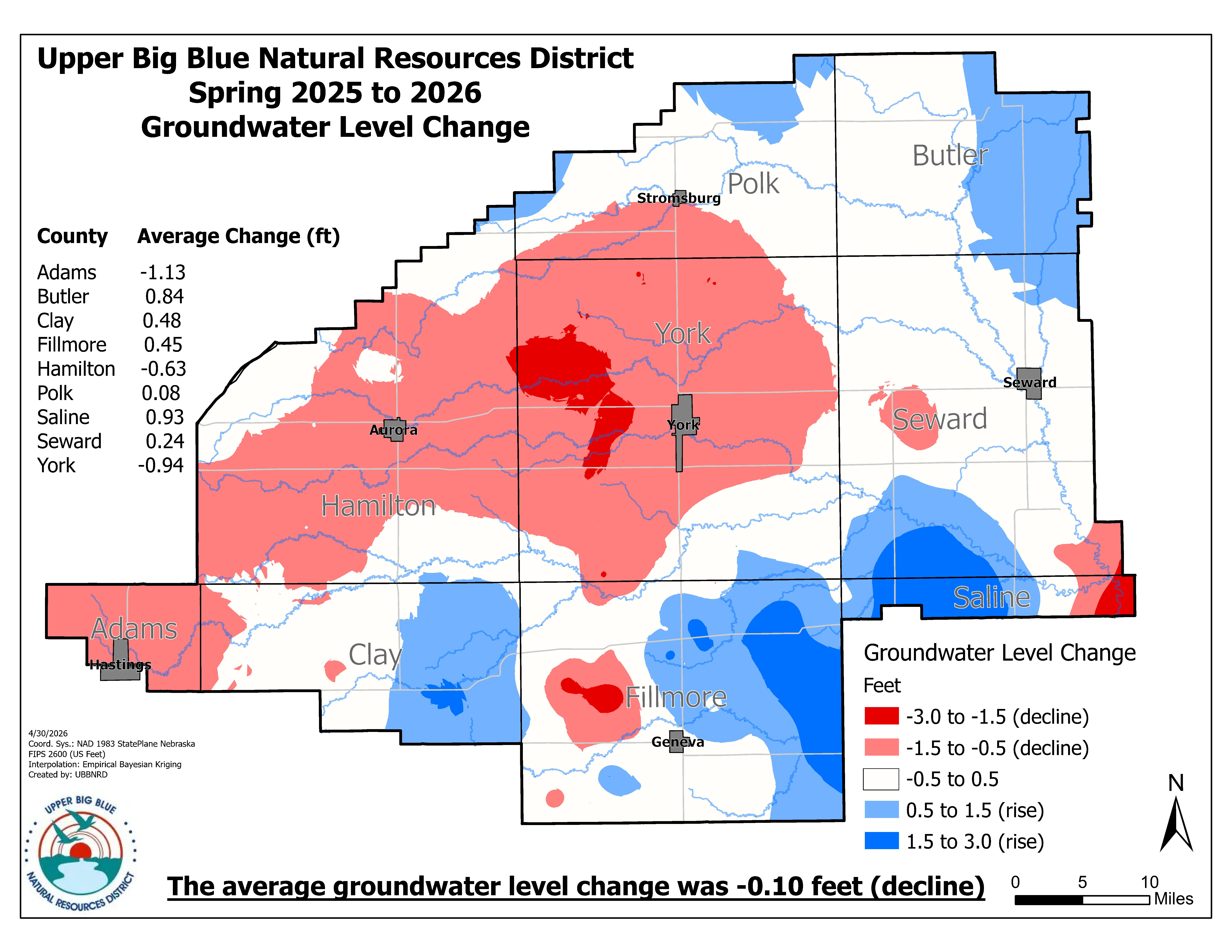
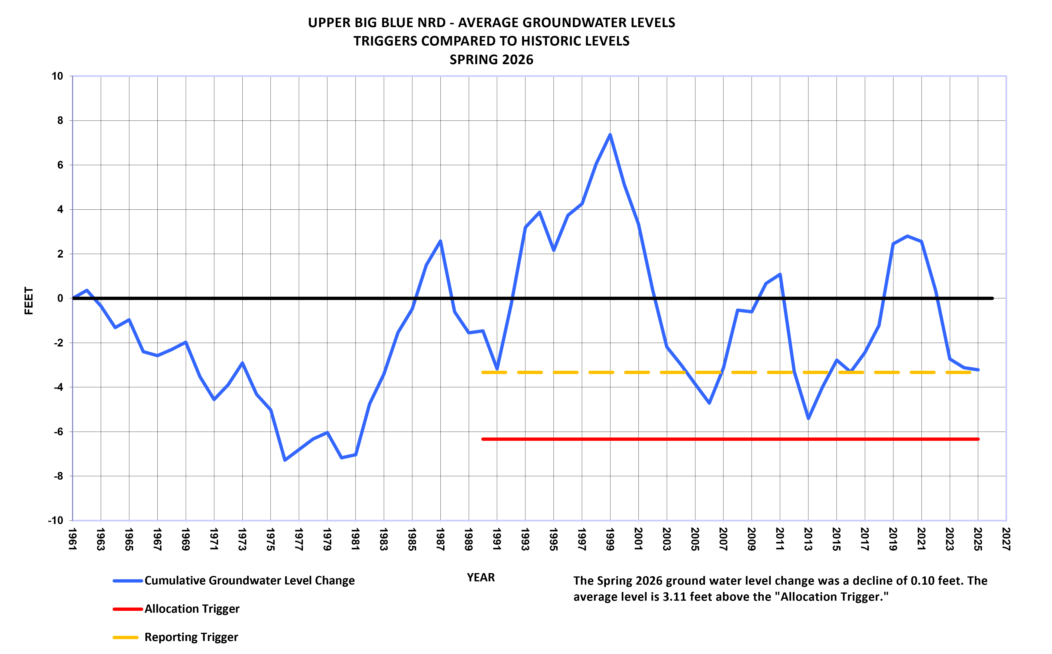
During March and April 2026, Upper Big Blue Natural Resources District (NRD) staff took groundwater level measurements from approximately 500 observation wells throughout the district. The goal of taking these measurements is to determine the average groundwater level change across the district, based on a weighted change from each well. Spring 2026 measurements show the average groundwater level decreased 0.10 feet from last spring but remains 3.11 feet above the “Allocation Trigger.” Thus, there will be no allocation restrictions for the 2027 irrigation season.
Observation wells are measured in the spring of each year, allowing the water table to rebound from the previous irrigation season. The wells are distributed throughout the district to provide an accurate profile of the average groundwater level change. Each well represents a specific area of the district. The groundwater level measurement for each well is weighted based on the percentage of the total area of the district it represents. The weighted values are then used to calculate the average groundwater level change across the district.
Spring 2024 and spring 2025 measurements showed average decreases of 3.08 feet and 0.39 feet, respectively, compared to a 0.10 feet decrease in 2026. Fluctuations from year to year are common throughout the district. The district sits above the High Plains Aquifer, which stretches from South Dakota to Texas. This portion of the aquifer is dynamic and different factors like rainfall and pumping affect how the aquifer reacts.
Water use records enable informed management decisions and practices
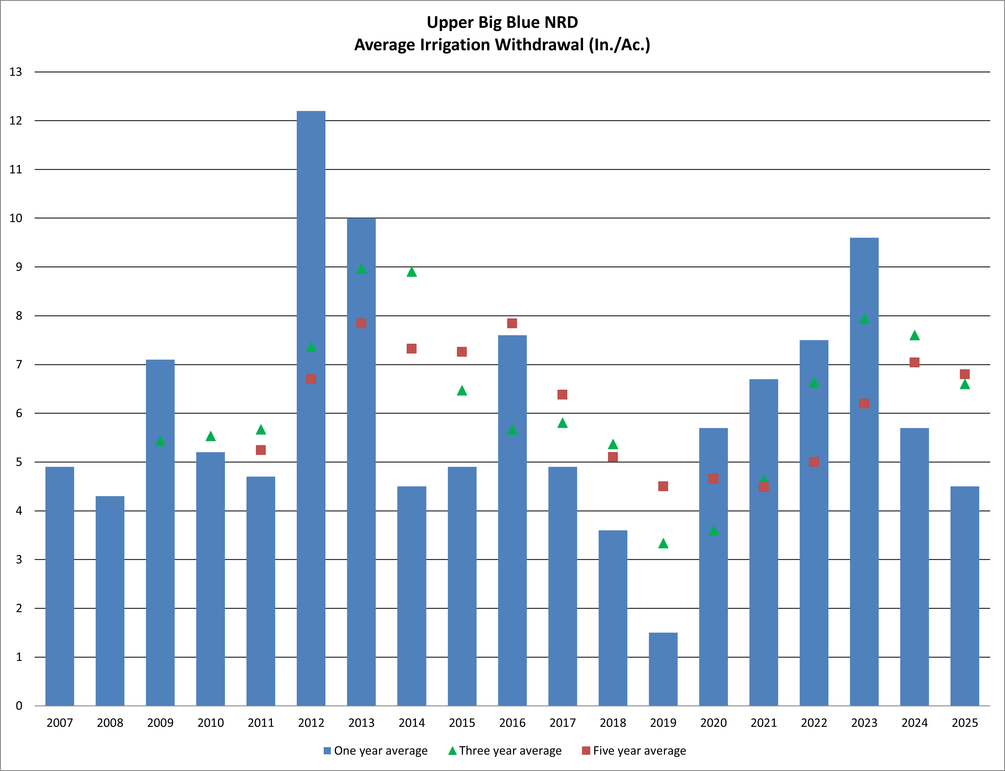
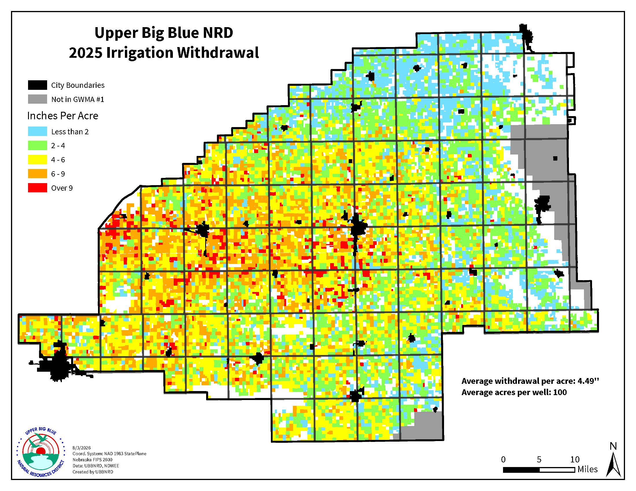
Data from observation well measurements and groundwater use reports are maintained by the NRD for historical reference and to assist with making informed management decisions. In 2005, the district’s average groundwater level fell below the “Reporting Trigger,” initiating groundwater users to report annual groundwater use to the NRD and to certify their irrigated acres. In 2025 the average groundwater usage across the district was 4.49 inches, which is below the average of 6.1 inches/year as calculated since 2007. Irrigation technologies have improved the ability of producers to manage water use to help ensure groundwater levels remain above the “Allocation Trigger.”
Groundwater levels within the district were first measured in 1961. In 1978, the average groundwater level measurement was 6.33 ft below the 1961 level. The NRD’s goal is to hold the average groundwater level at or above the 1978 level, which is the “Allocation Trigger.” If the average groundwater level in the district falls below this point, then allocation will begin.