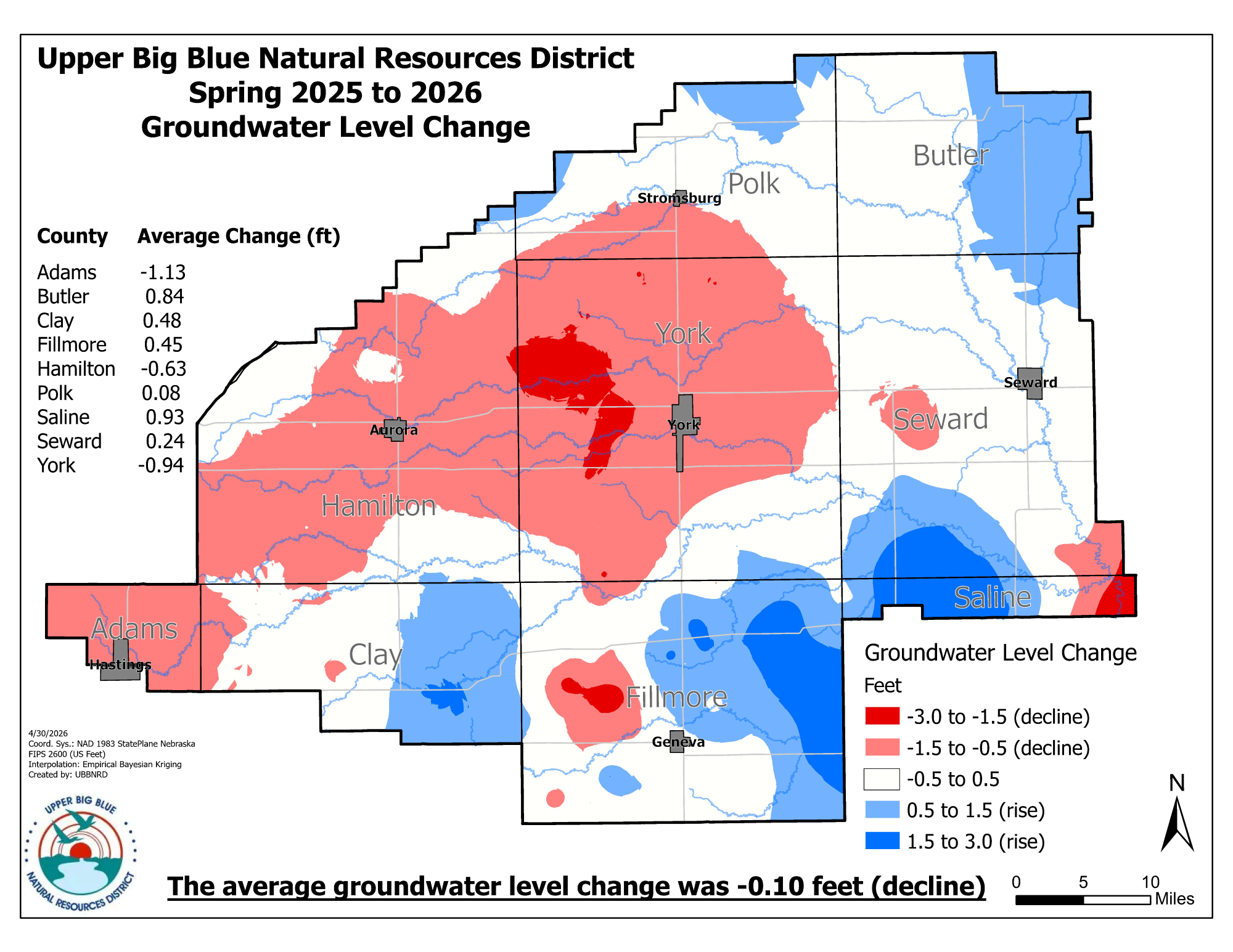
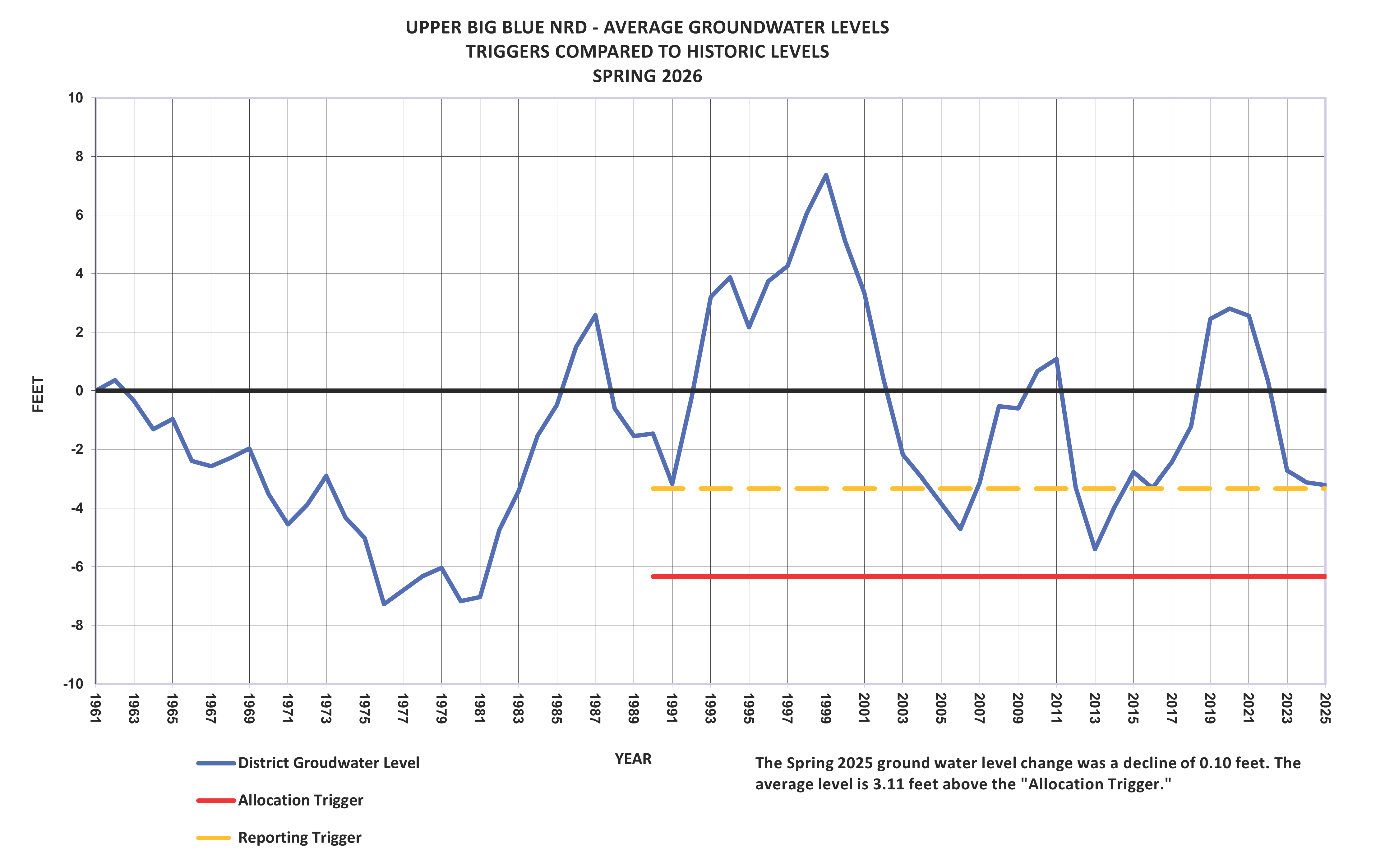
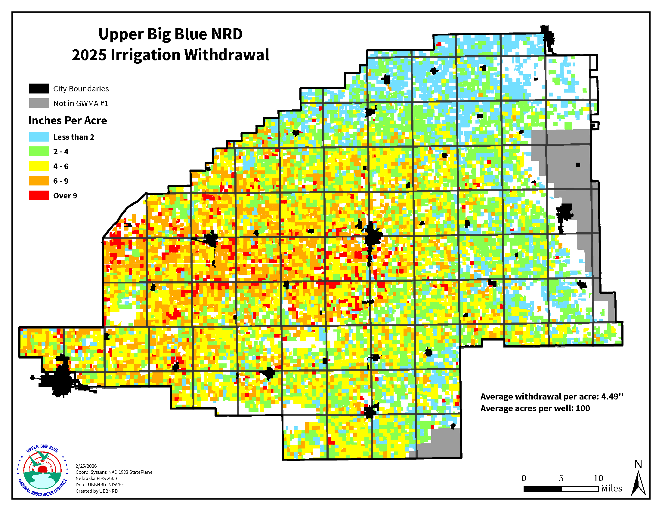
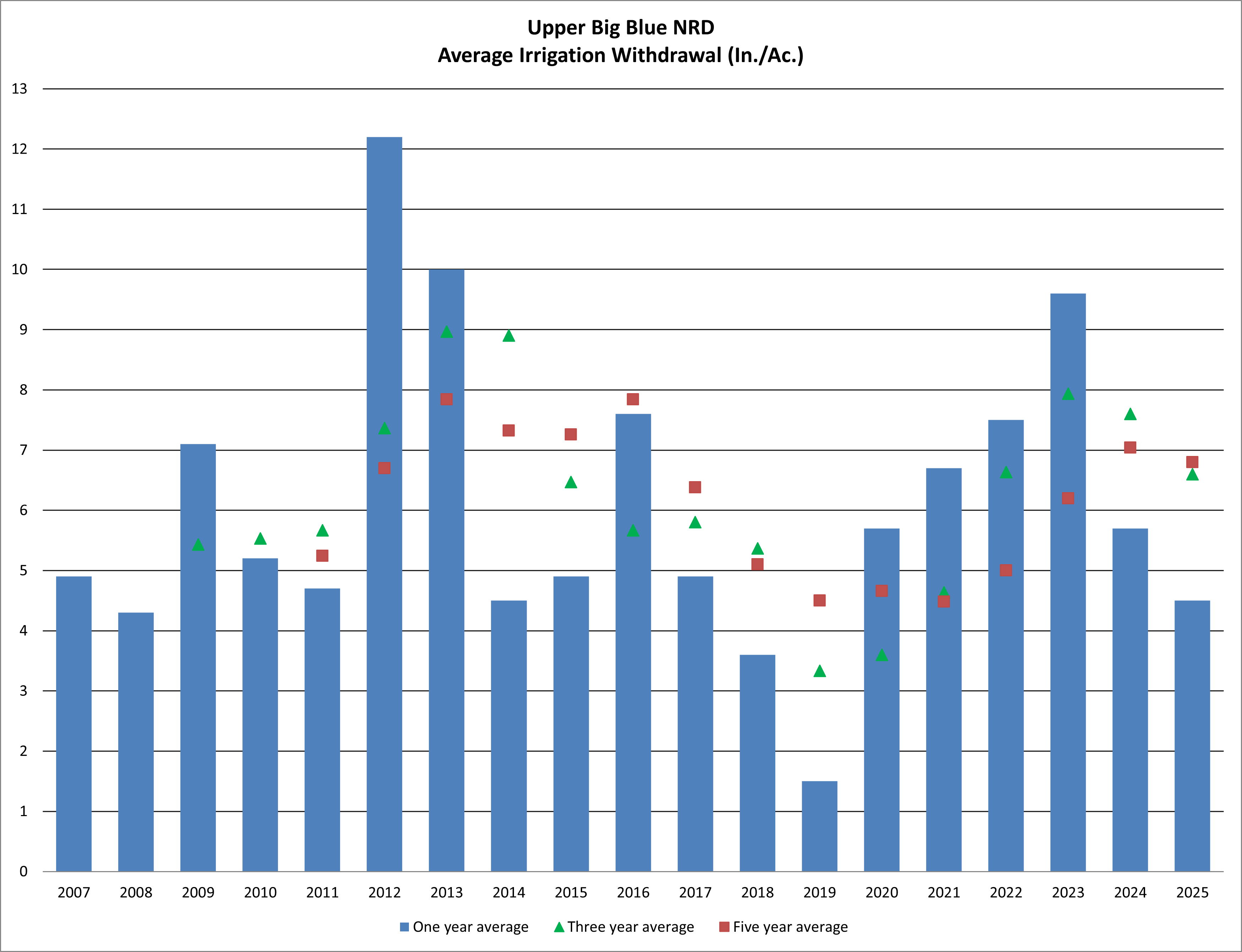
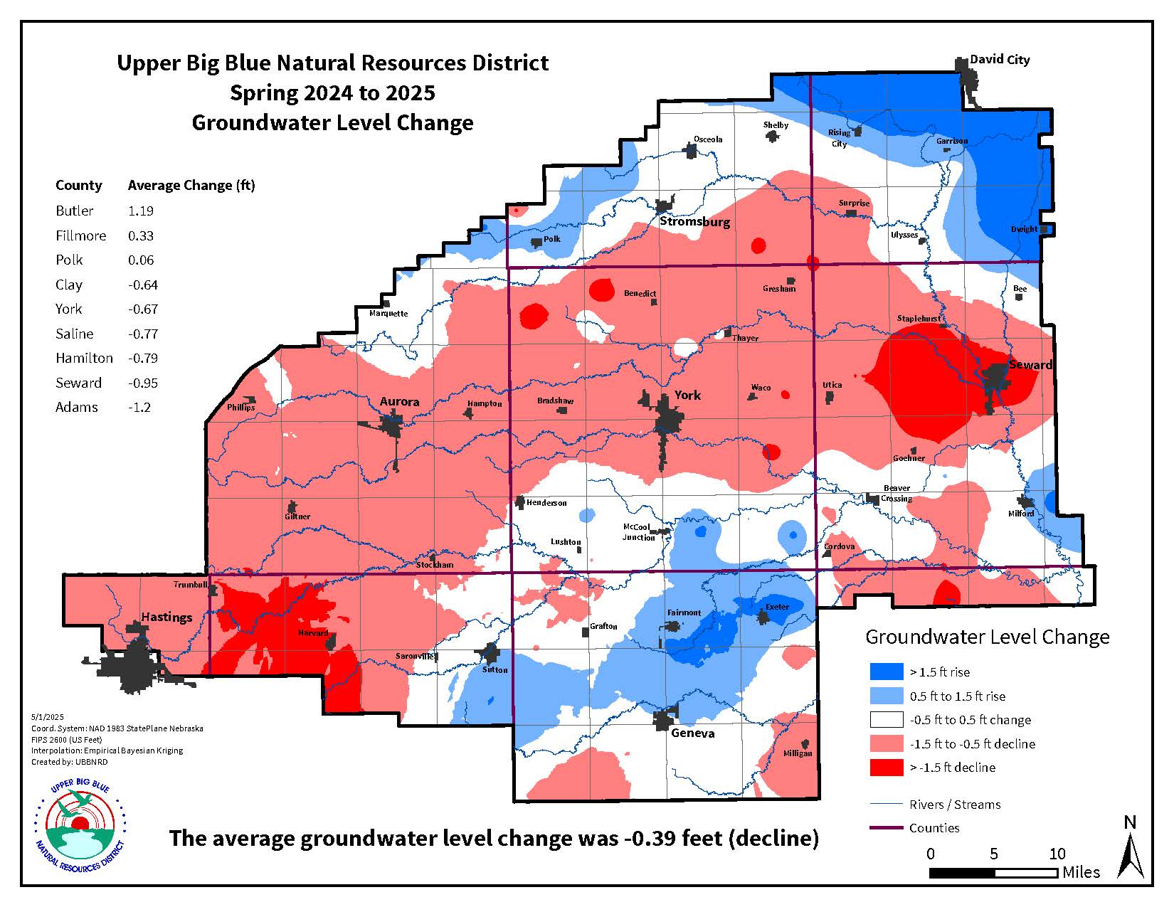
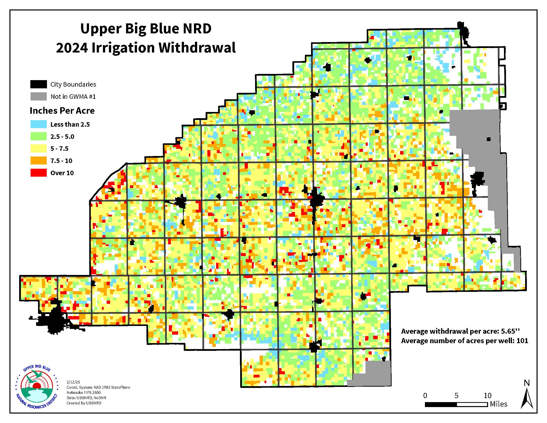
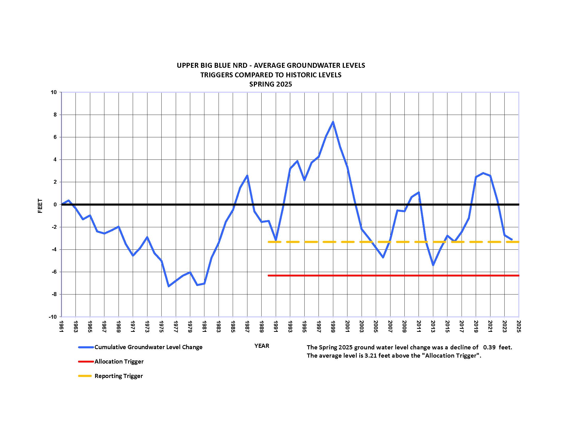
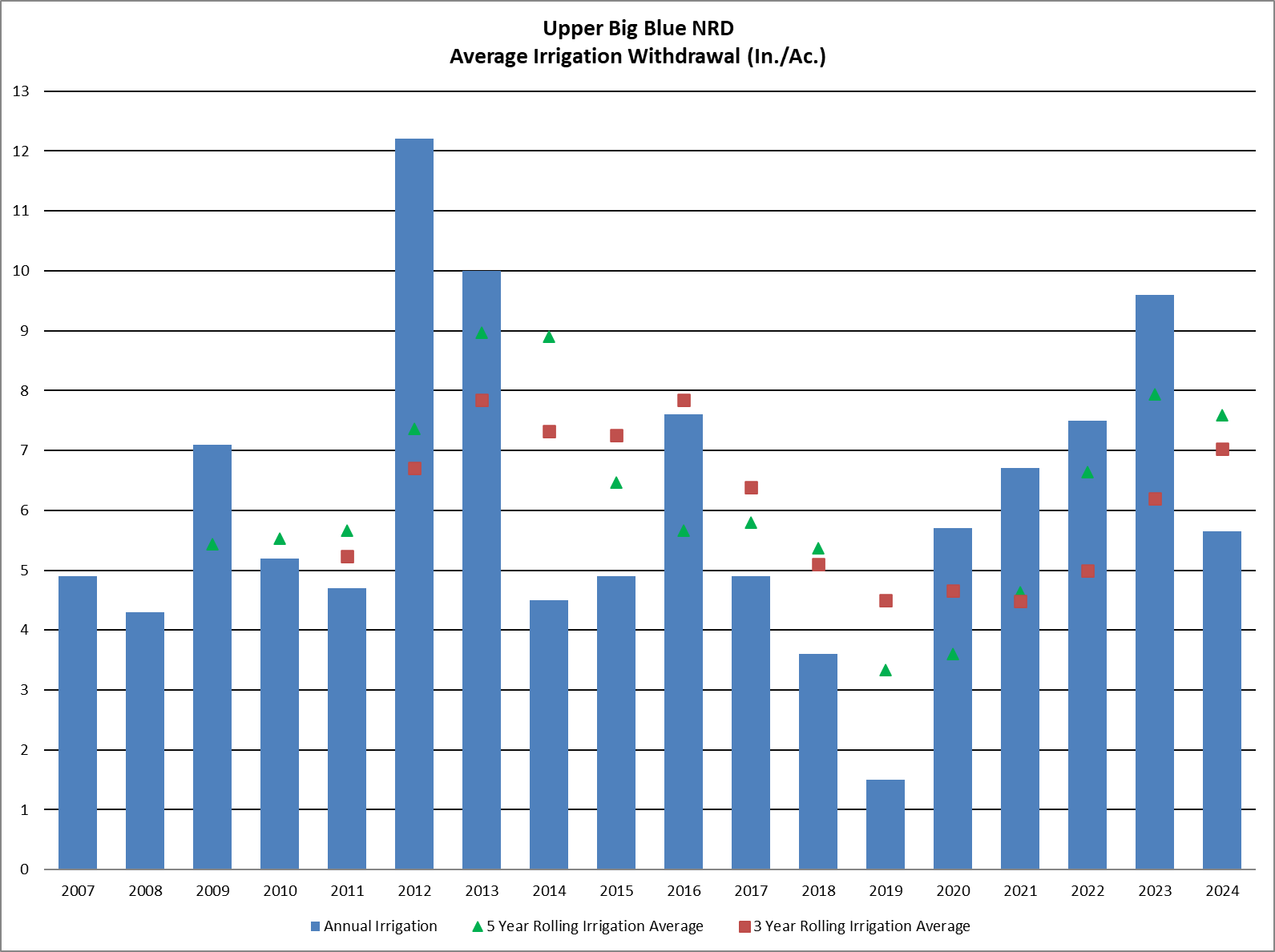
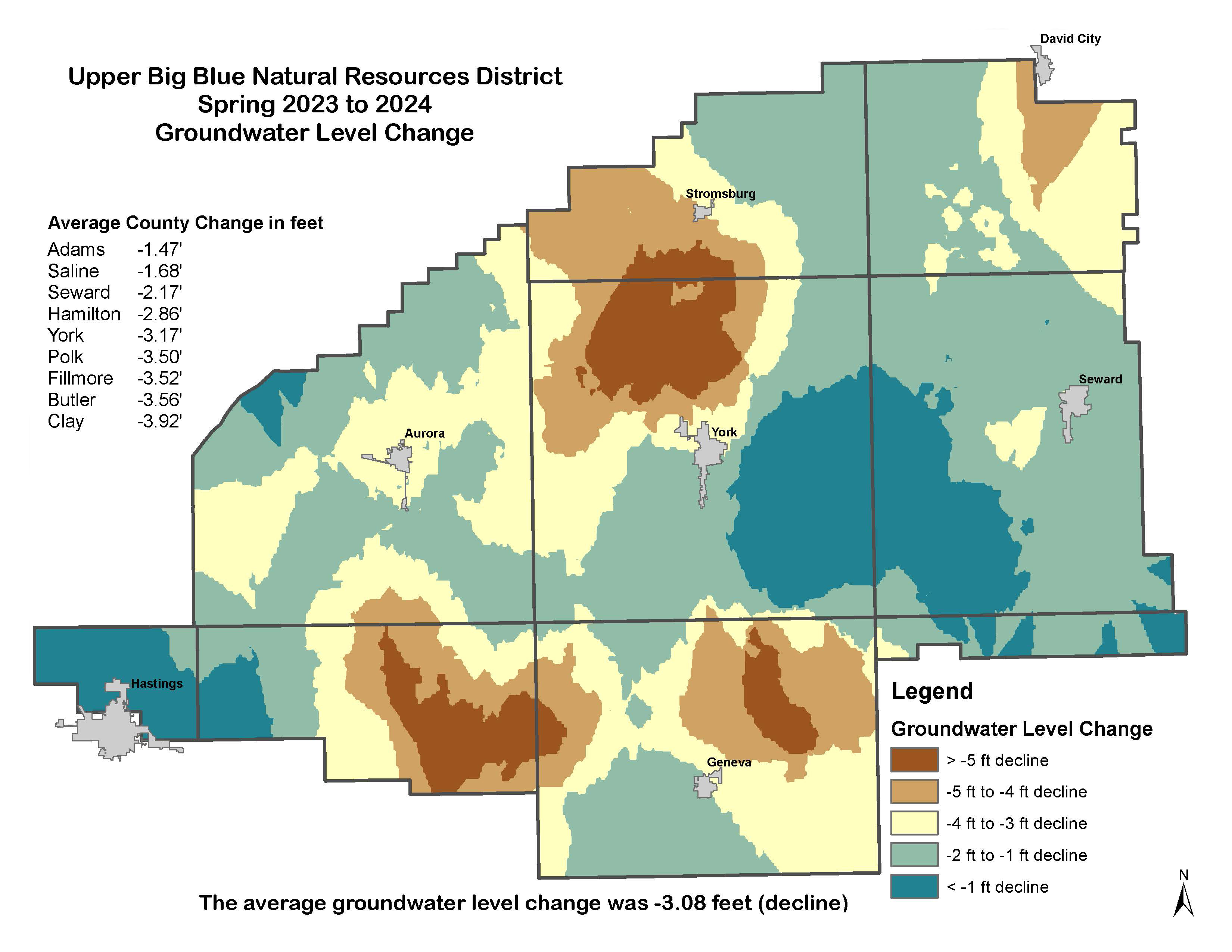
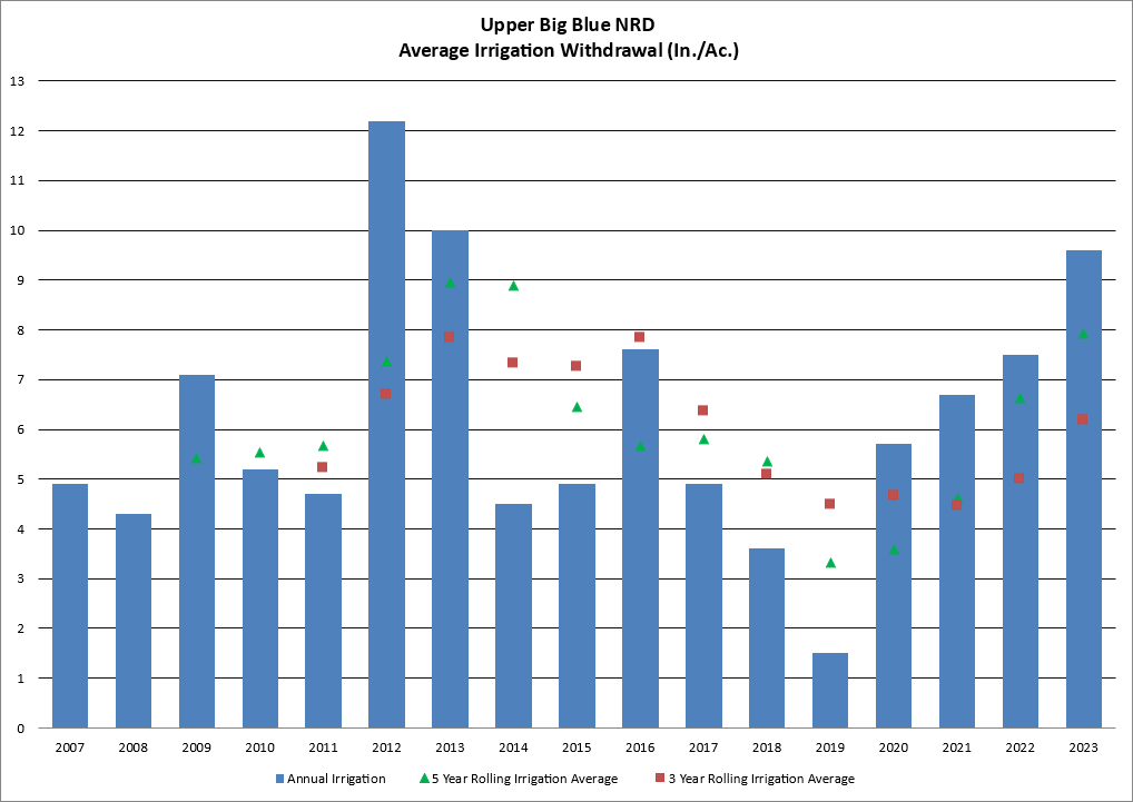
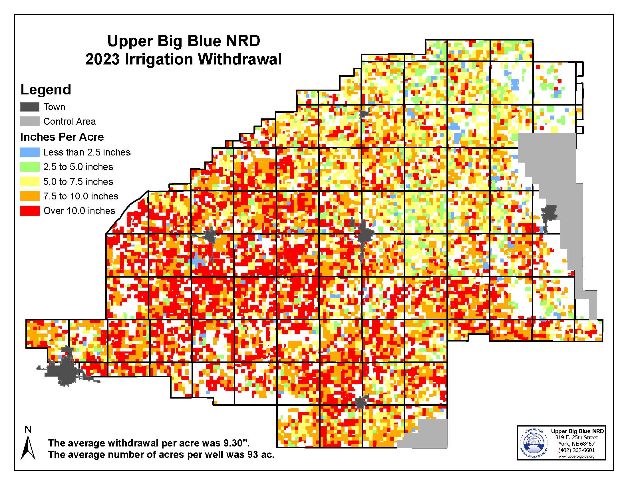
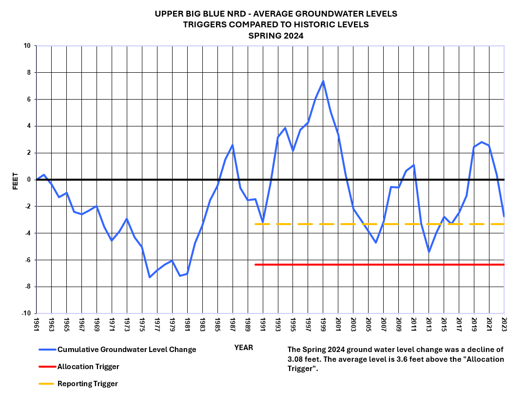
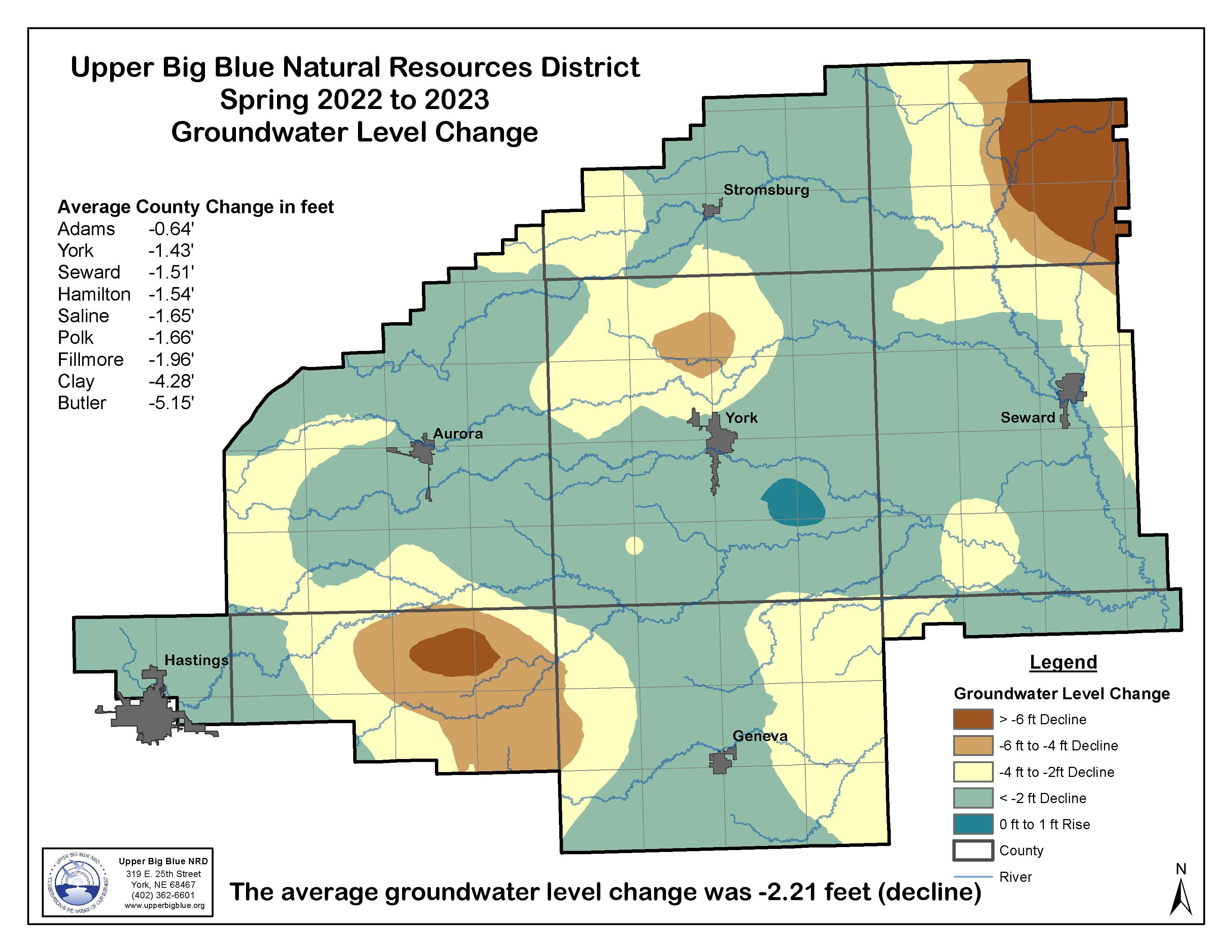
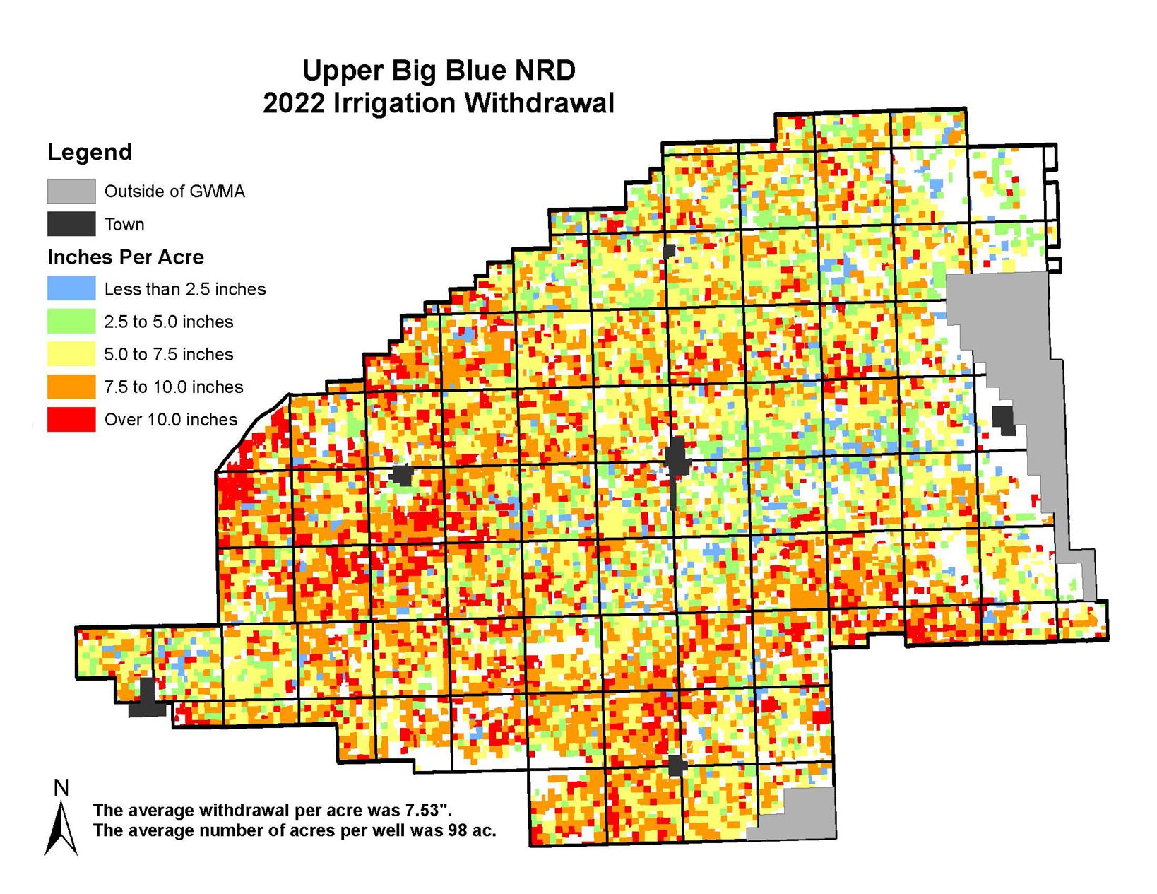
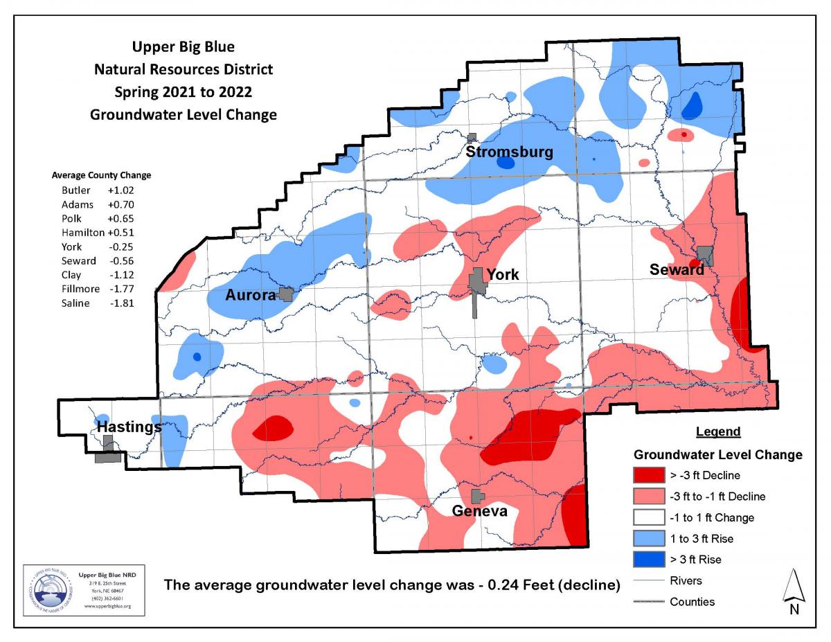
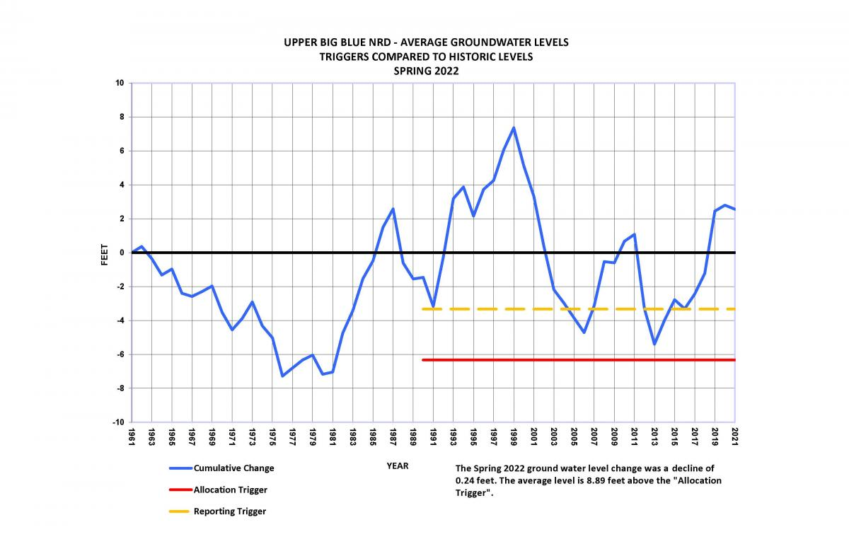
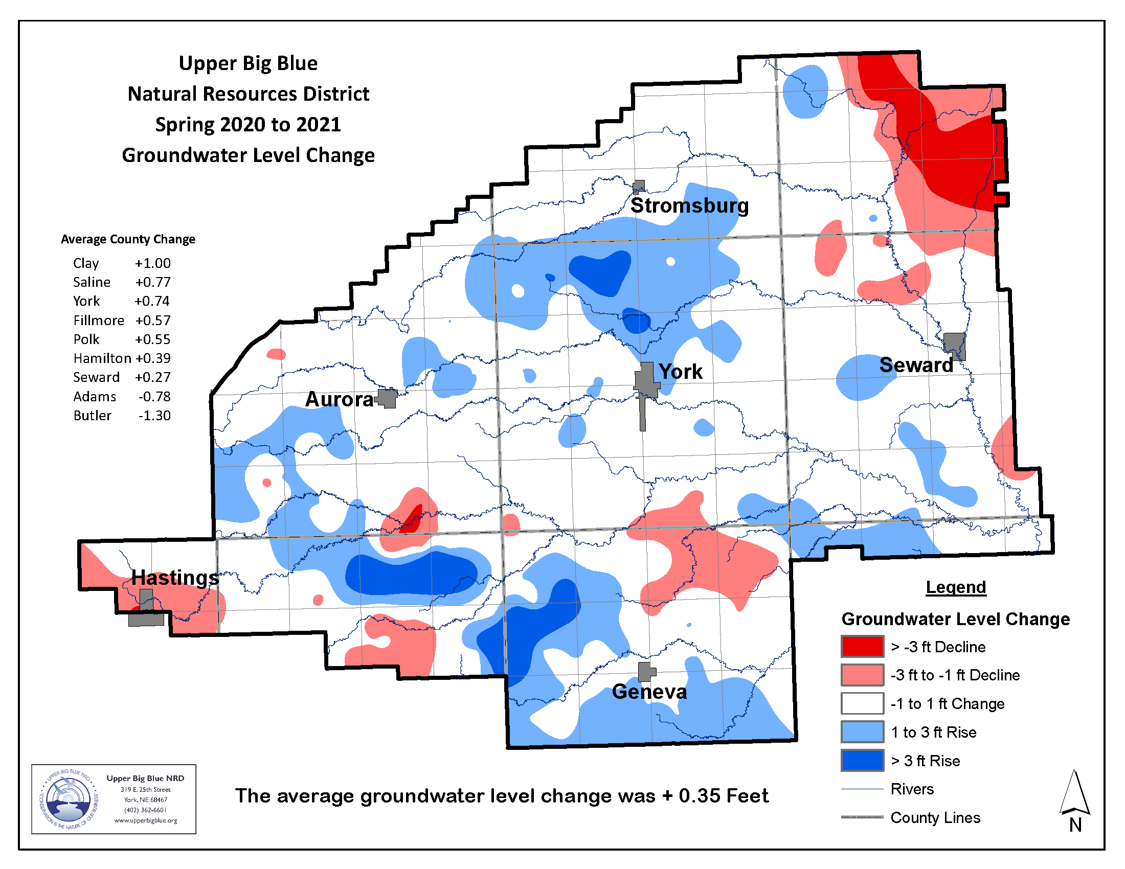
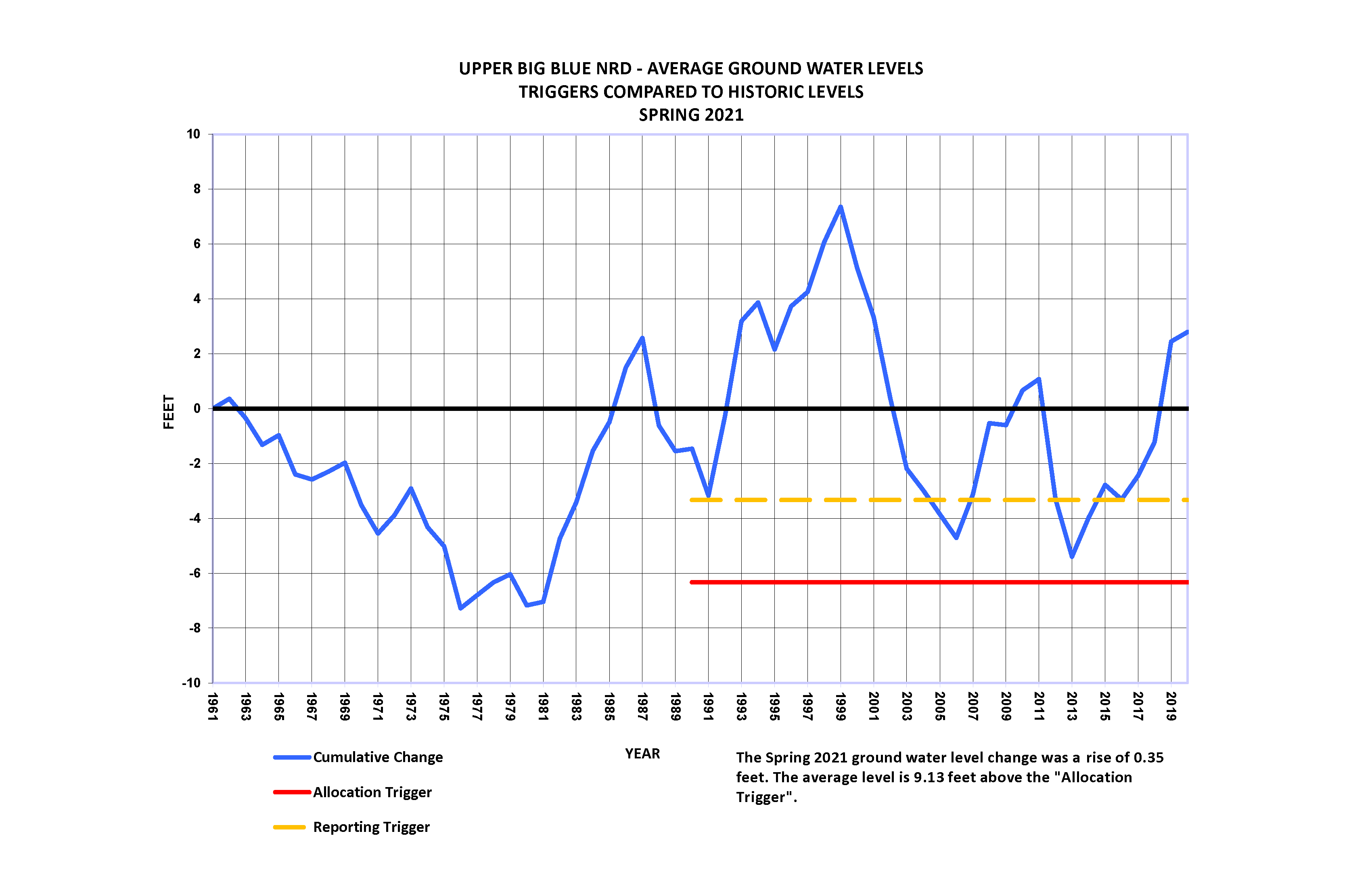
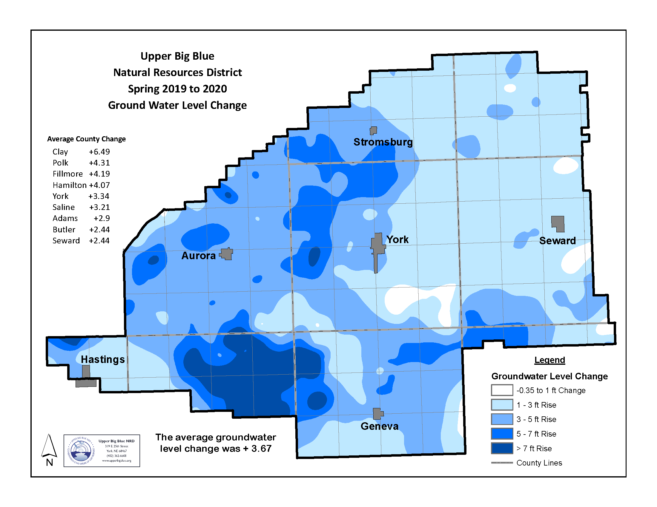
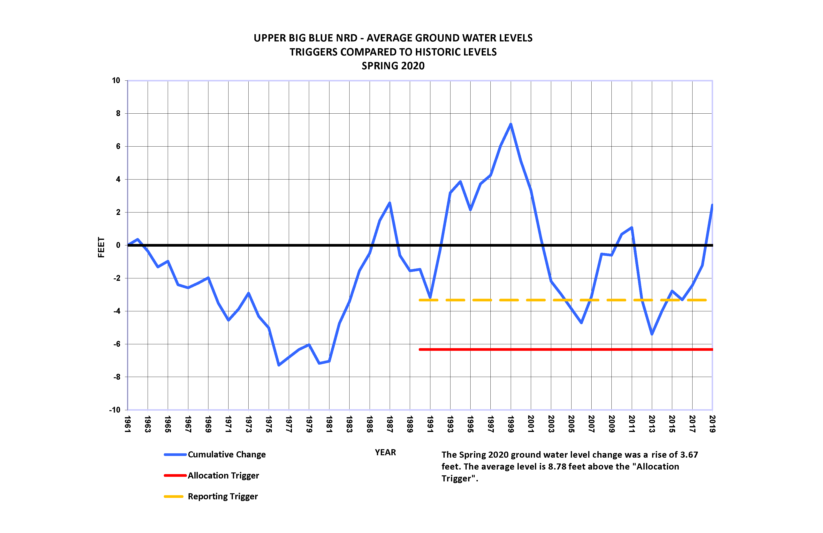
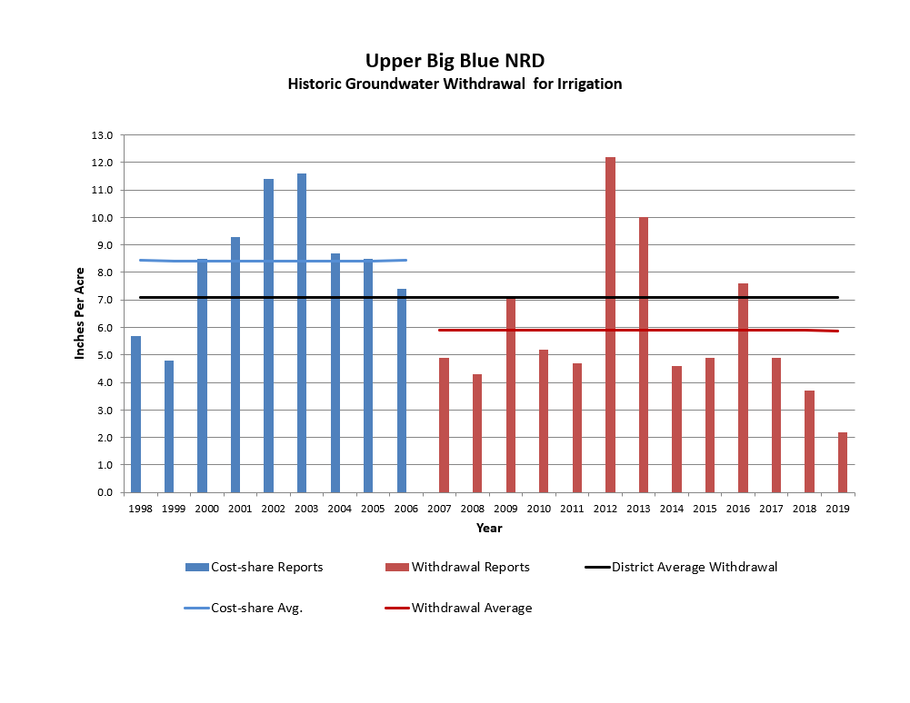
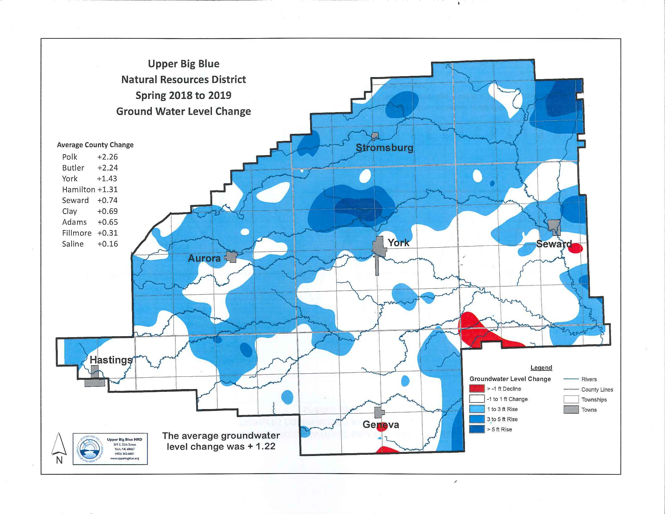
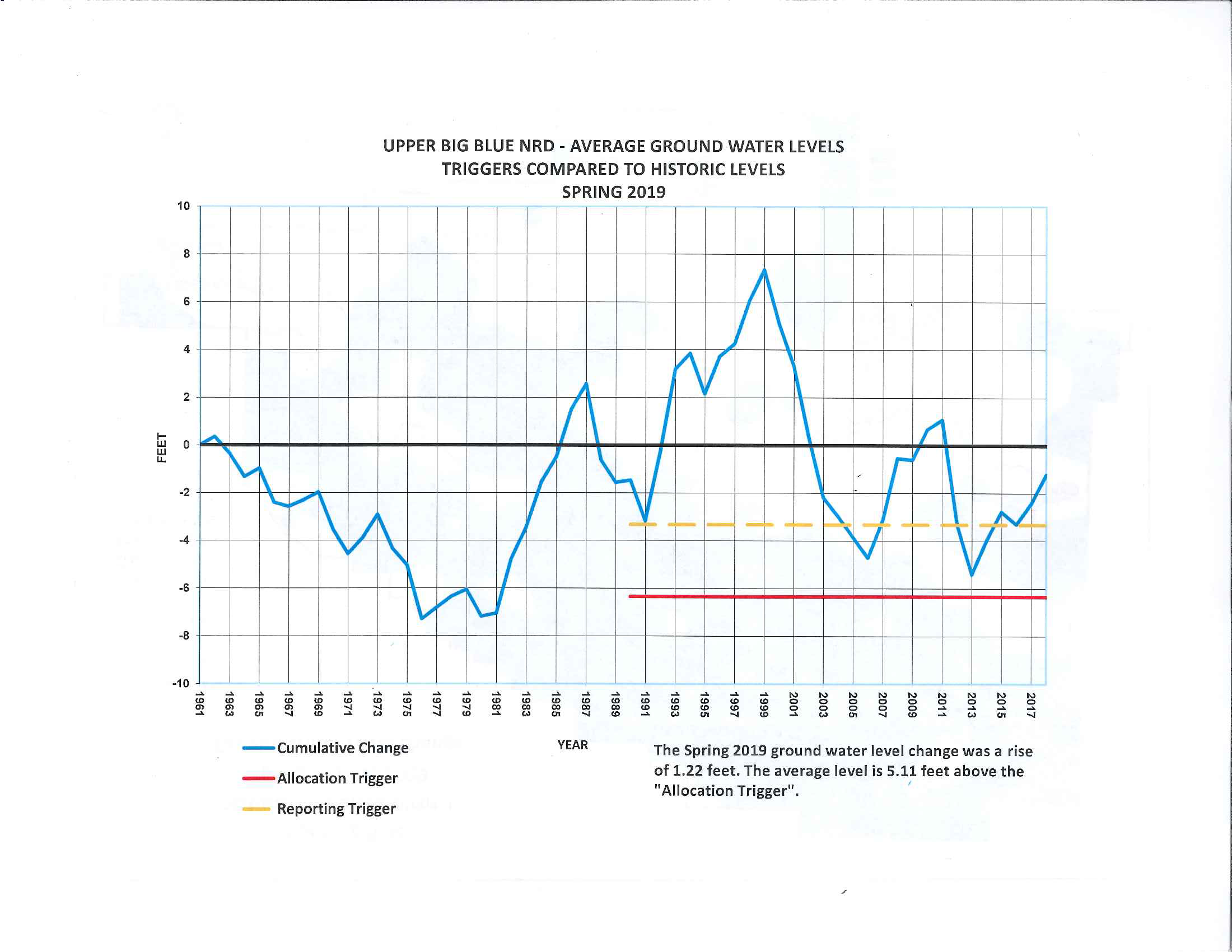
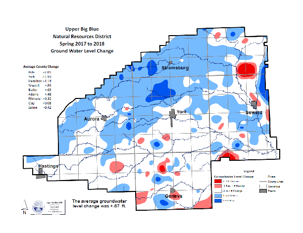
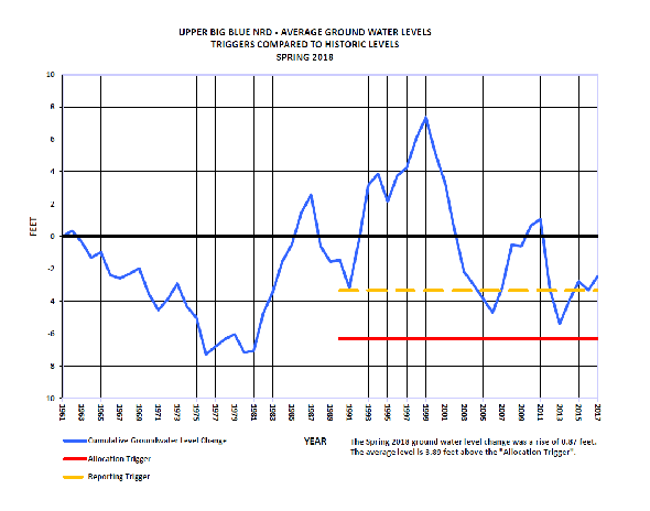
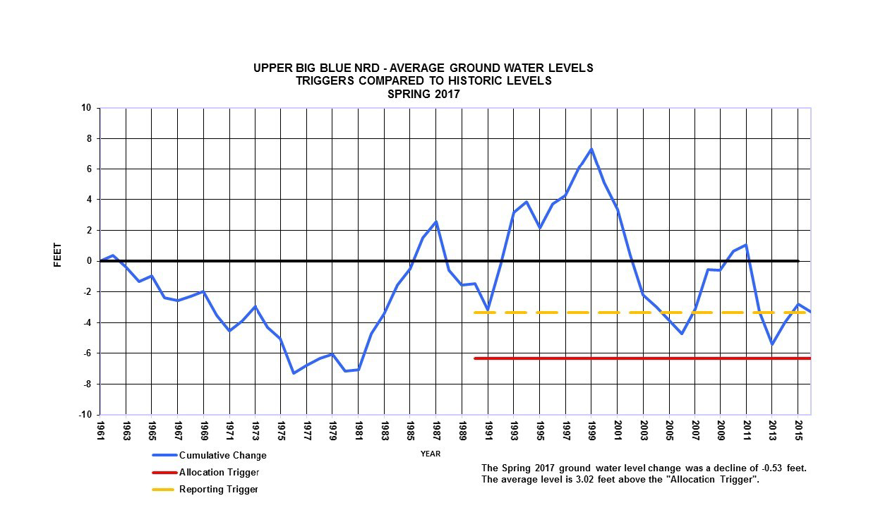
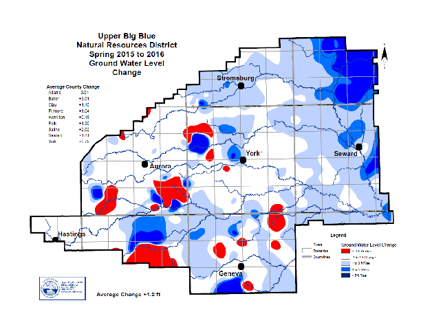
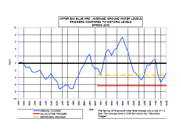
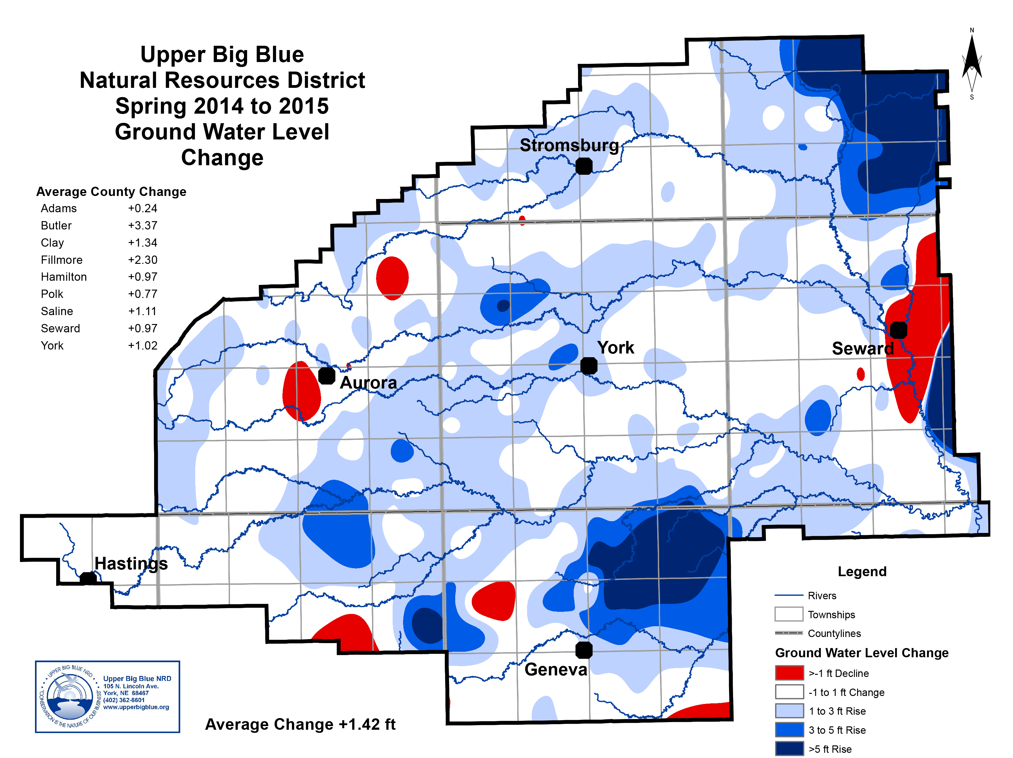
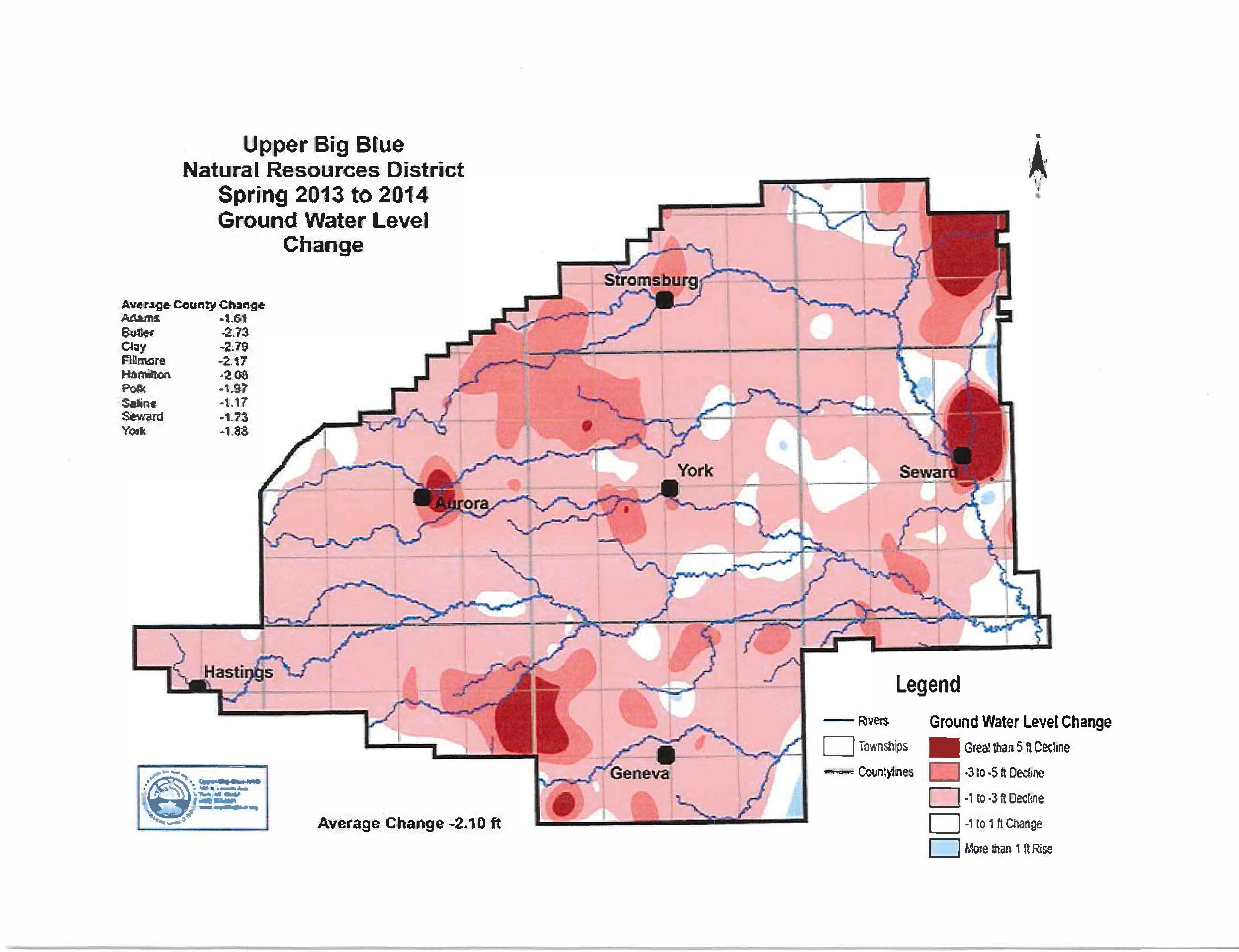
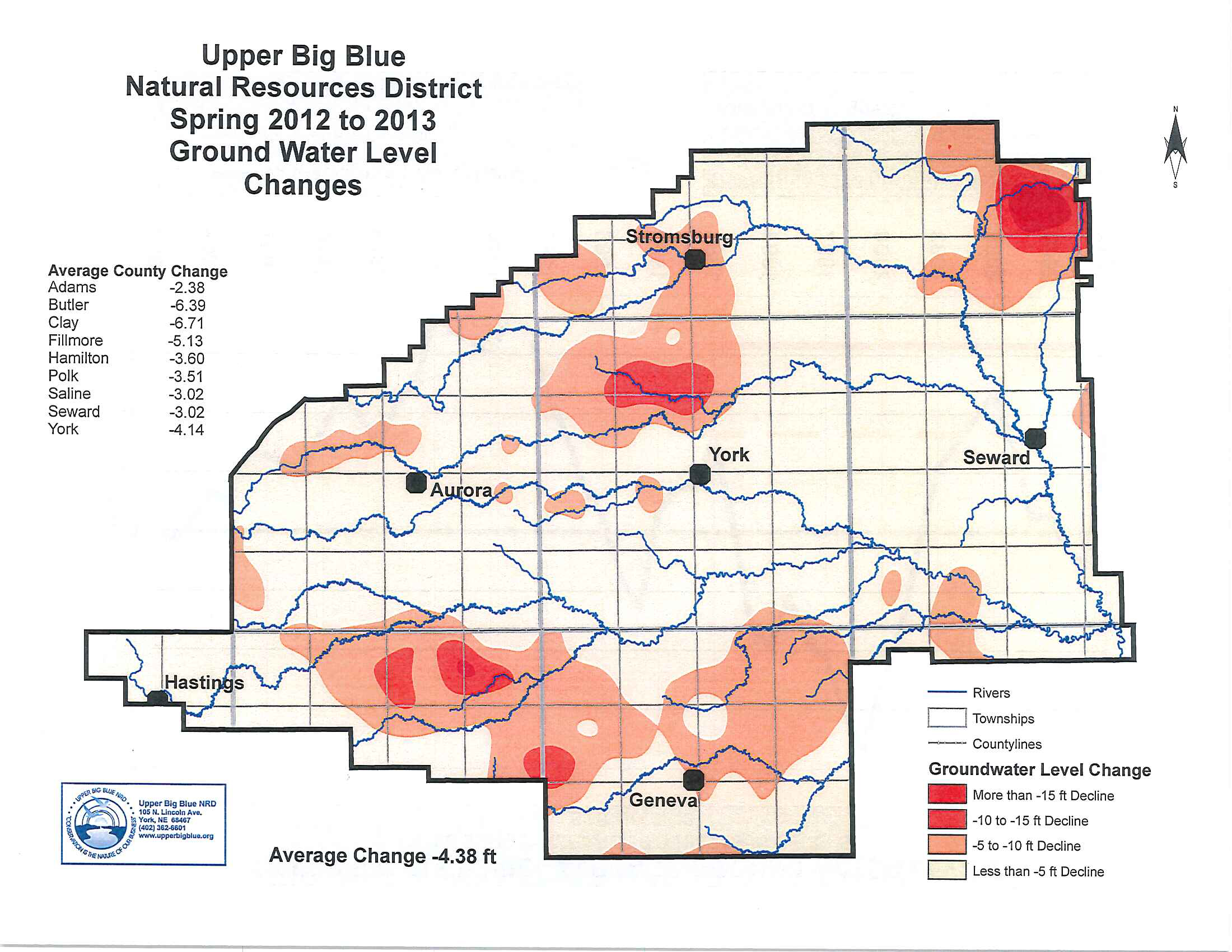
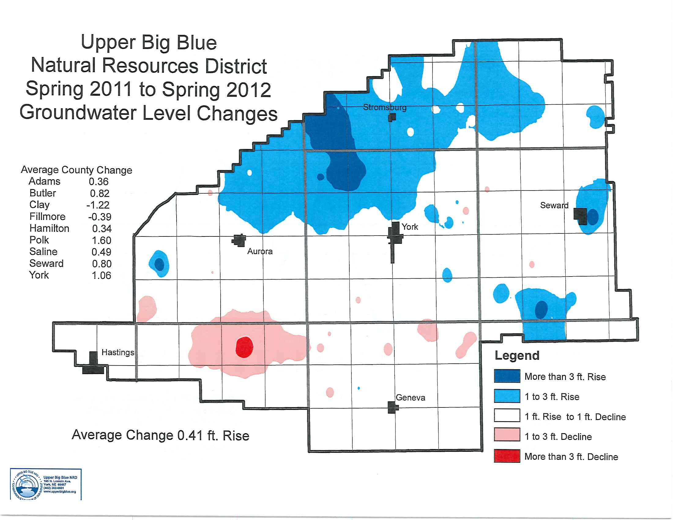
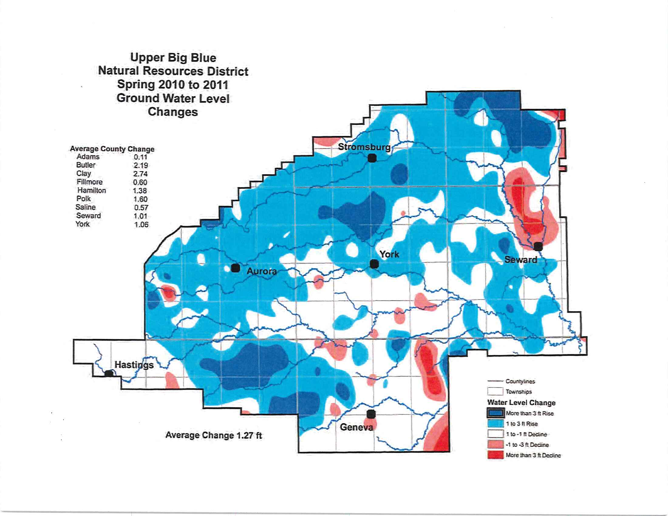
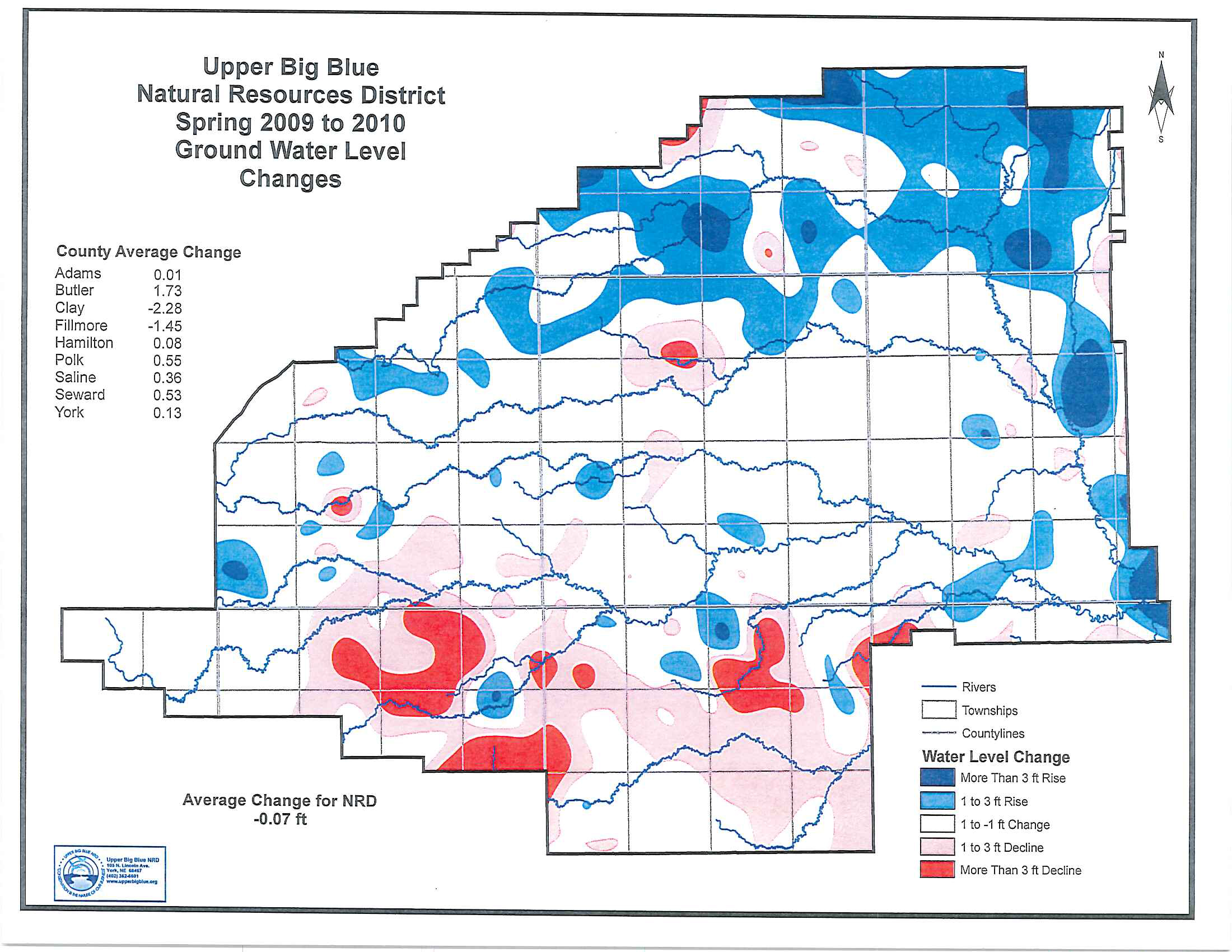
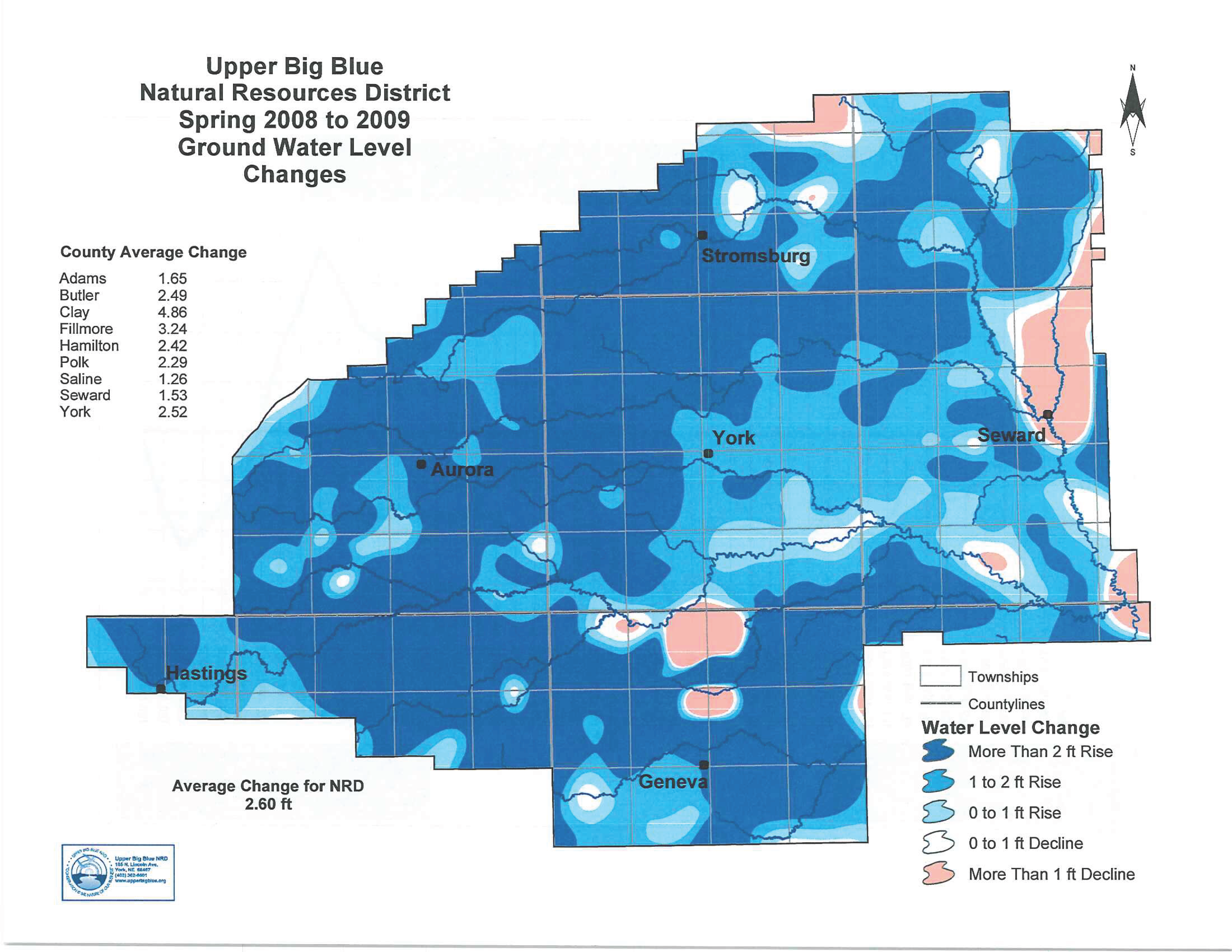
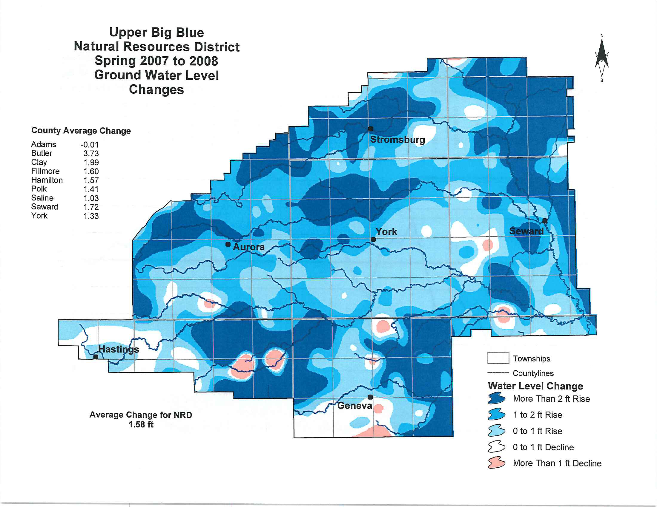
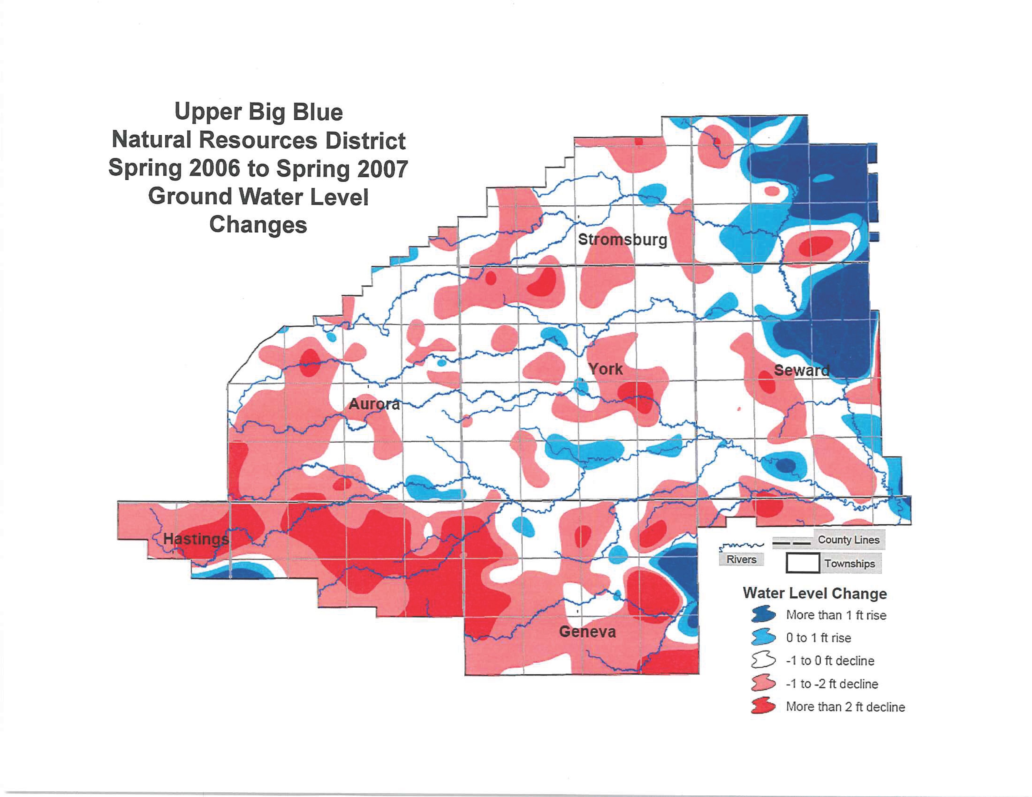
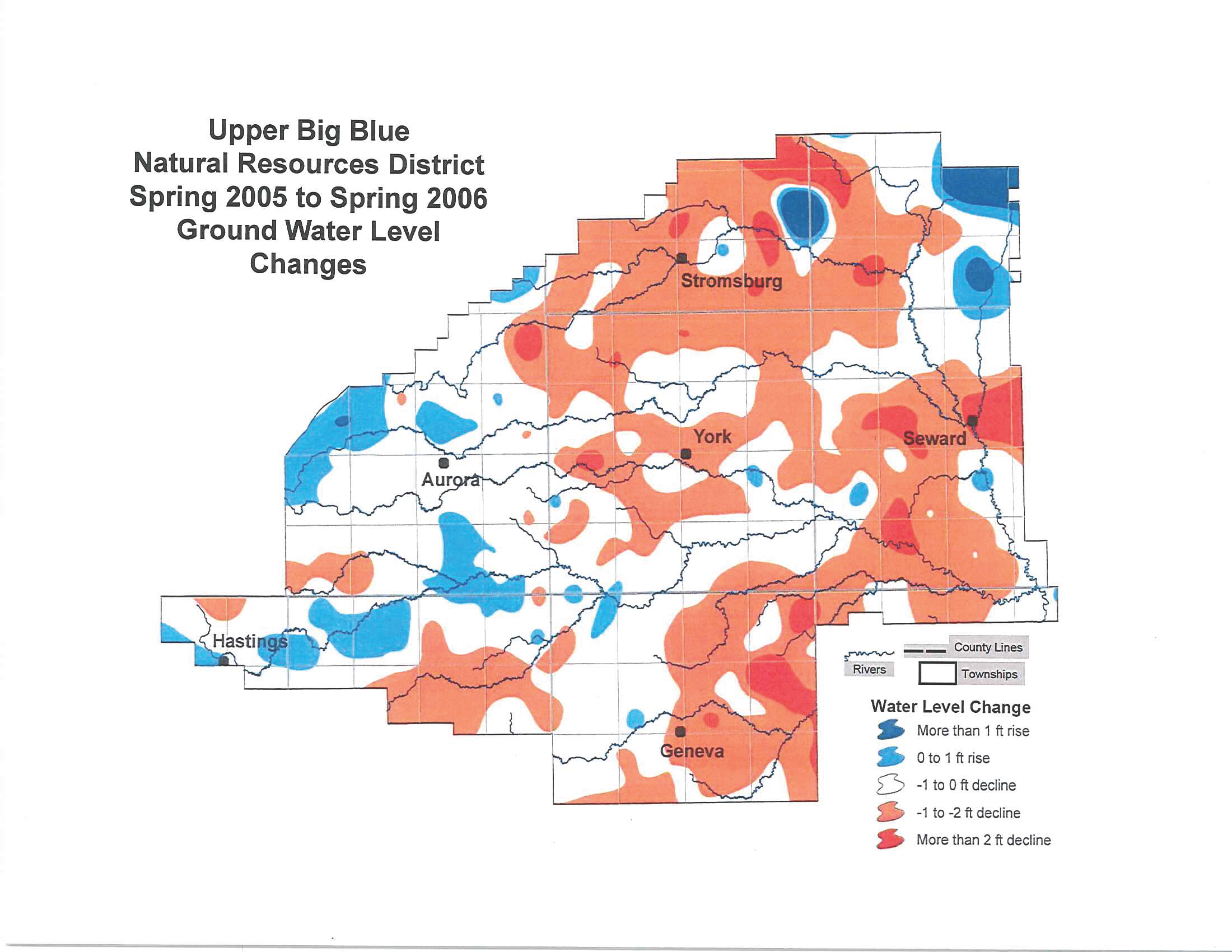
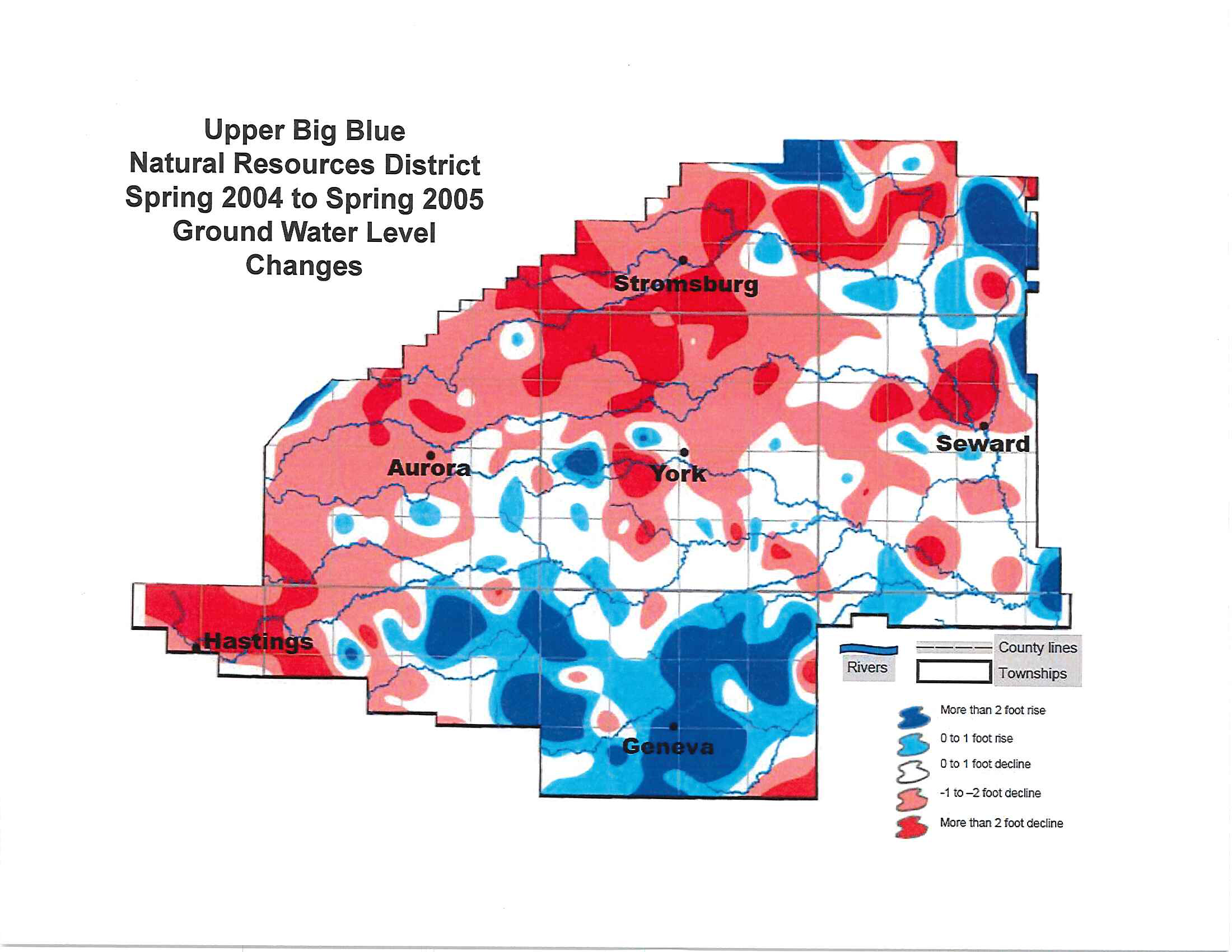
Top Menu

  • Search
  • Resource Browser

I Want To...

  • Report Online
  • Pay a Bill Online
  • Check Groundwater Levels
  • Find Funding for Practices or Land Treatment
  • Apply for a Reverse Osmosis Rebate
  • Find Camping
Home

Main navigation

  • About
    • Areas of Responsibility and Pillars
    • Board of Directors
    • Staff
    • Rules & Regulations
    • Partnering Agencies
    • Events
    • News
    • Employment
    • Frequently Asked Questions
    • Bid Proposals
  • Water
    • Online Reporting
    • Groundwater Quantity
    • Groundwater Quality
    • One District, Two Plans, One Water
    • Research
    • Forms
  • Trees
    • Conservation Tree Program
    • Tree Care Resources
    • Windbreaks & Large Plantings
    • Tree Programs
  • Projects
    • Cost-Share Opportunities
    • Conservation Plantings
    • Land Treatment
    • Water Management Groundwater Programs
    • Wildlife Habitat Programs
  • Education
    • Scholarships
    • Educational Assistance
    • Fast Facts
    • NRD History
    • Project GROW
    • Publications
    • Turnbull Prairie
  • Recreation
    • Bruce L. Anderson (Recharge Lake)
    • Overland Trail
    • Oxbow Trail
    • Pioneer Trails
    • Smith Creek
    • Teal View Wetland Education Area
    • Recreation Area FAQs
    • Rec Area Rules
  • Contact
Menu

Groundwater Levels

Groundwater Quantity

  • Online Reporting
  • Groundwater Quantity
    • Certifying Irrigated Acres
    • Flow Meters
    • Fully Appropriated Area
    • Groundwater Withdrawals
    • NERAIN
    • Water-TIP
    • Well Permits
    • Groundwater Levels
    • High Risk Groundwater Areas
    • Water Transfers
    • Allocation
  • Groundwater Quality
  • One District, Two Plans, One Water
  • Research
  • Forms

Groundwater Levels

Groundwater Levels

Each spring, the staff of the Upper Big Blue Natural Resources District takes measurements to determine the change in the groundwater level after it has rebounded from the previous season's irrigation use. New data is added annually in May.

Ground Water Level Change Maps

2024-2025

Groundwater Levels Decline Slightly, Remain Above Allocation Trigger

withdrawal

2023-2024

Groundwater Levels Continue to Decline, Yet Remain Above Allocation Trigger


2023-2024 groundwater level change map


irrigation averages
irrigation withdrawal


triggers

2022-2023

  • Groundwater level declines significantly, yet remains above allocation trigger

groundwater level change 2022-2023

withdrawal 2022-23


historic water levels water use

2021-2022

Change map 2022

Water Level Change Graph 2022

2020-2021

Change map 2021


Water Level Change Graph 2021

2019-2020

2019-20 map

19-20 graph1

19-20 graph 2

2018-2019

2019 map

2019 graph

2017-2018

2018 map

2018 graph

2016-2017

2017 map

2017 graph

2015-2016

2016 map

2016 graph

2014-2015

2015 map

2013-2014

2014 map

2012-2013

2012 map

2011-2012

2011 map

2010-2011

map

2009-2010

map

2008-2009

map

2007-2008

map

2006-2007

map

2005-2006

map

2004-2005

map

Get Updates to Your Inbox

Sign Up
We will never flood your inbox, spam you, or sell your info.

Social Media

  • Facebook
  • Twitter
  • Instagram
  • youtube
  • LinkedIn

Contact Info

  • 319 E 25th St. York, NE 68467
  • (402) 362-6601
  • info@upperbigblue.org
  • Data Privacy Statement

Footer Main navigation

  • About
  • Water
  • Trees
  • Projects
  • Education
  • Recreation
  • Contact
© 2025 Upper Big Blue NRD
• Privacy Policy
• Accessibility
• Website Design & Development by UNANIMOUS
  • About
    • Areas of Responsibility and Pillars
    • Board of Directors
      • District Maps
      • Meetings
    • Staff
    • Rules & Regulations
    • Partnering Agencies
    • Events
    • News
    • Employment
    • Frequently Asked Questions
    • Bid Proposals
  • Water
    • Online Reporting
    • Groundwater Quantity
      • Certifying Irrigated Acres
      • Flow Meters
      • Fully Appropriated Area
      • Groundwater Withdrawals
      • NERAIN
      • Water-TIP
      • Well Permits
      • Groundwater Levels
      • High Risk Groundwater Areas
      • Water Transfers
      • Allocation
    • Groundwater Quality
      • Water Testing
      • Chemigation
      • Nebraska Soil Carbon Project
      • Water Quality Management Plan
      • WQMP Incentive Program
      • Nitrogen Management
      • On-Farm Research
      • Nitrogen Reduction Incentive Act (NiRIA) Reimbursement Program
      • Point of Use Reverse Osmosis Water Filtration System Pilot Program
      • Calidad del Agua Subterránea
    • One District, Two Plans, One Water
    • Research
    • Forms
  • Trees
    • Conservation Tree Program
    • Tree Care Resources
      • How to Plant Your NRD Trees
      • Weed Barrier Fabric Mulch
    • Windbreaks & Large Plantings
      • Windbreaks: Why Bother?
      • Windbreak Success: Tips & Tricks
    • Tree Programs
      • Community Resources Programs
      • Parks Program
      • Storm Damaged Trees
      • Wildlife Habitat Programs
  • Projects
    • Cost-Share Opportunities
    • Conservation Plantings
    • Land Treatment
    • Water Management Groundwater Programs
    • Wildlife Habitat Programs
  • Education
    • Scholarships
    • Educational Assistance
    • Fast Facts
    • NRD History
    • Project GROW
    • Publications
    • Turnbull Prairie
  • Recreation
    • Bruce L. Anderson (Recharge Lake)
    • Overland Trail
    • Oxbow Trail
    • Pioneer Trails
    • Smith Creek
    • Teal View Wetland Education Area
    • Recreation Area FAQs
    • Rec Area Rules
  • Contact
  • Search
  • Resource Browser
  • Report Online
  • Pay a Bill Online
  • Check Groundwater Levels
  • Find Funding for Practices or Land Treatment
  • Apply for a Reverse Osmosis Rebate
  • Find Camping